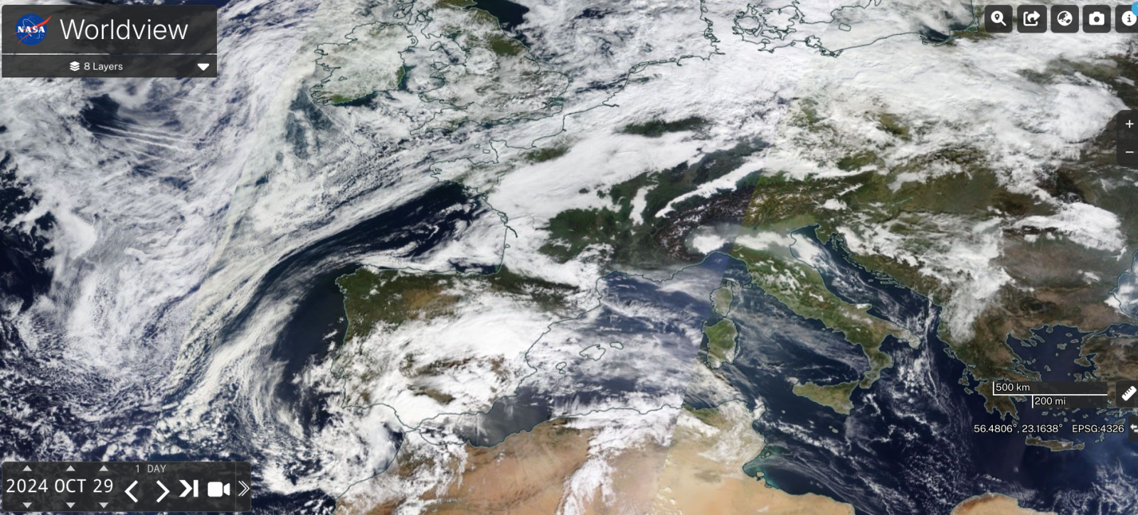
High pressure will keep a lot of settled, steady weather over the UK and central Europe. With the jetstream away to the north one midweek low over Scandinavia has brought snow to the Arctic Circle and another low will skirt north of Scotland towards Bergen before deepening over the Baltic States by Friday. The cold front from this low will bring rain to northern Scotland during Thursday night and reach the Central Belt by Friday midday but otherwise, it is a mostly dry outlook.
The anticyclone keeps our weather steady as the northerly jetstream takes low pressure elsewhere but there has been extreme rainfall over Spain. Earlier in the week a large meander in the jetstream resulted in a cut-off upper low over southeastern Iberia. As explained in “DANA weather system to bring heavy rain and flooding to parts of Spain this week” there has been extreme rainfall in parts of Spain and catastrophic flooding. At least 50 people have died. There are many, many cars strewn about after being lifted in surging waters. Bridges collapsed and there is debris over roads and railways, as the waters begin to recede leaving filth. Rural and mountainous villages are still inaccessible with people being rescued by helicopter on Tuesday 29th, the peak of the rain event.
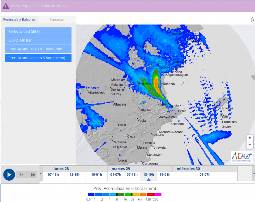
Eastern Spain usually experiences the autumn ‘Gota Fria’, the Cold Drop which results in heavy rain and flooding as cold northerly winds encounter warm, moist air from the Mediterranean. This time the impacts have been more widespread and intense, in time frame and also rainfall amounts with over 400mm in under a day. This type of atmospheric setup is called DANA, (Depresion Aislada en Niveles Altos) an isolated low pressure/depression in the upper atmosphere and it is the combination of this slow-moving upper low and the surface warm, moist air which brought devastation.
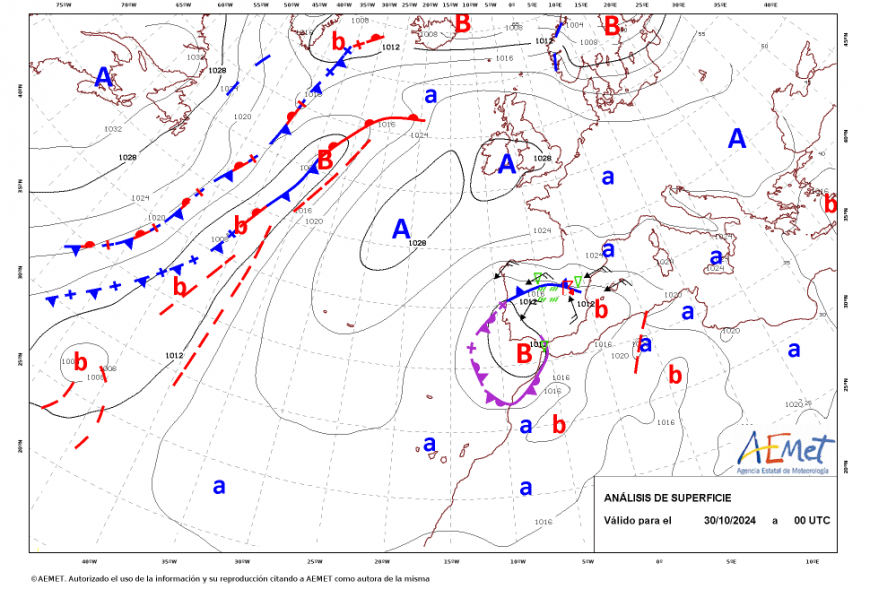
Although the worst of the rain has passed, Portugal will see rain later this week including the Algarve. There will be more wet weather with heavy showers likely along the south and east coast of Spain and over the Balearics at the weekend.
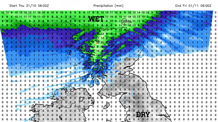
For the UK there are old faded weather fronts under high pressure. In places, there is a lot of cloud but Scotland has seen more sunshine although with patchy light rain over the Western Isles. For the Halloween crowd this evening there could be some spooky mist for southern and eastern Britain. Temperatures will dip away into single figures in northern Scotland as skies clear although the wind will freshen in the far northwest. And by dawn on Thursday it will feel cooler for England and Wales where the skies have cleared with hardly any breeze.
Thursday looks dry by day for all by the NW Highlands and Islands, where it will be damp and grey. The brisk SW/W wind will continue into the evening of the 31st for northern Scotland. It will be mild, windy in the north, calm in the south and perhaps cooler with mist and fog forming.
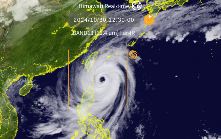
An unwelcome visitor for the 31st around the other side of the world will be Super Typhoon Kong-Rey.
Kong-rey is a large cyclone forecast to make landfall in the less poplauted southeast of the islands on Octooer 31st but to dump houge amounts of rain in the populated north. This huge cyclone is rather late in the year for a direct hit on tawiwan. As schools close, flights adn rail services are being cancelled and fisherfolk warned not to head out to sea.
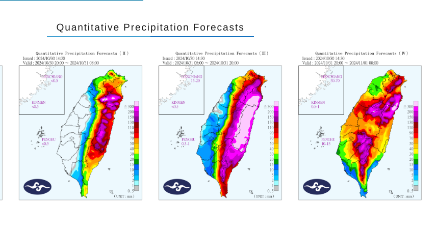
Kong-rey is expected to dump the heaviest rain on Taiwan’s eastern and northern coastal areas, and over the mountains in the central and southern regions, the Central Weather Administration said.
Eastern areas have been warned to prepare for landslides, flooding and debris flows with lashing rain, wild winds and large waves along the coasts.

