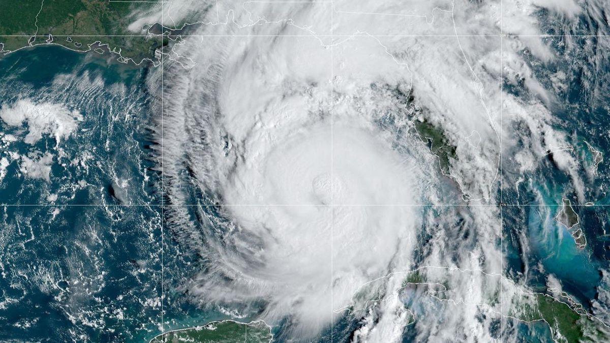
A hurricane that is barreling toward Florida’s coast could be one of the most dangerous storms in recent history to hit the state, forecasters say.
Hurricane Helene, which has been drawing strength from record-breaking warm waters in the Gulf of Mexico, is now a Category 3 storm and is expected to hit Florida’s coast Thursday (Sept. 26) night or Friday (Sept. 27) morning, according to the National Hurricane Center (NHC).
As of 4 p.m. EDT, Helene had maximum sustained winds of 120 mph (193 km/h) and was moving northeast at 21 mph (33 km/h), with hurricane-force winds extending up to 60 miles (95 kilometers) from its center, according to the NHC.
Once it makes landfall, Helene is expected to produce a significant storm surge of up to 20 feet (6 meters) above normal sea level. Storm-surge warnings are in effect along portions of Florida’s Big Bend coast, and the surge has been forecast to be “unsurvivable” at Apalachee Bay, according to a warning issued by the Tallahassee branch of the National Weather Service (NWS).
“A catastrophic and deadly storm surge is likely along portions of the Florida Big Bend coast, where inundation could reach as high as 20 feet above ground level, along with destructive waves,” the U.S. NWS wrote on X. “There is also a danger of life-threatening storm surge along the remainder of the west coast of the Florida Peninsula.”
This is a potentially unsurvivable storm surge height.
“When you’re talking about a storm surge greater than 10 feet [3 m] — which we’re talking about for a large portion of the Florida Big Bend region — this is a storm surge that is very difficult to survive,” Daniel Brown, the branch chief of the the National Oceanic and Atmospheric Administration’s (NOAA) Federal Hurricane Specialist Unit, told Live Science. “Ten feet is over the heads of humans and the water is going to be moving, [there will be] a lot of wave action especially right along the coast.”
Brown said that the surge, which will owe its size to the shape of the Florida coastline and the size of the hurricane, will probably have the strength to damage or destroy buildings along the coast, meaning that people should evacuate immediately.
“People should not be there,” Brown said. “You don’t have to go hundreds of miles, you just have to get out of the storm surge area.”
Hurricanes grow from a thin layer of ocean water that evaporates due to winds. That moisture rises to form storm clouds. The warmer the ocean is, the more energy the system gets, pushing the formation process into overdrive and enabling violent storms to rapidly take shape. This is why hurricane season occurs from June to November and why the most powerful storms in the Atlantic usually occur between August and September, when ocean temperatures peak.
Related: We may need a new ‘Category 6’ hurricane level for winds over 192 mph, study suggests
Scientists previously discovered that climate change has made extremely active Atlantic hurricane seasons much more likely than they were in the 1980s. Since March 2023, average sea surface temperatures around the world have hit record-shattering highs, giving storms such as Helene an extra shot of strength before they hit land.
Once Helene makes landfall, it is expected to move through Florida and then continue inland across Georgia, Tennessee and Alabama — a path that has put millions under hurricane and tropical storm warnings.
“Water is the number one reason that we see people lose their lives in these storms. So, please don’t underestimate what the impacts could possibly be,” FEMA Administrator Deanne Criswell said at a White House news conference Wednesday (Sept. 25). “You need to listen to your local officials. If they tell you to evacuate, please do so. And if they tell you to shelter in place, then that’s what you should do. They’re going to give you the best information that you can do for your specific situation. Those decisions can save lives.”

