

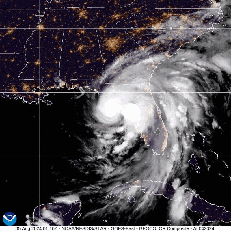
Hurricane Debby has now strengthened to a Category 1 storm as it charts a path towards the Florida Big Bend region, where it is expected to make landfall on Monday morning.
The National Hurricane Center warned that, as of around 5am ET, Debby has sustained winds of up to 80mph and is located just 40 miles from Cedar Key.
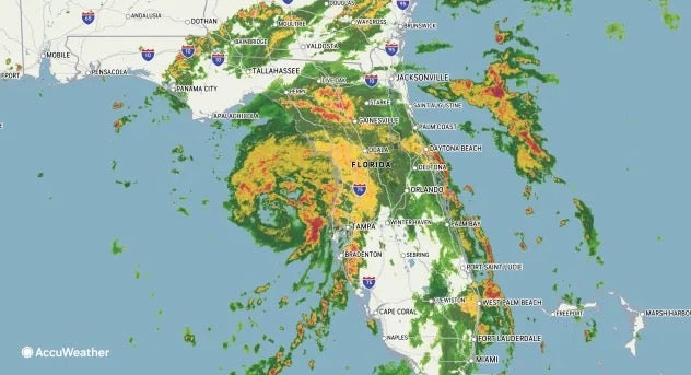
The hurricane is expected to bring life-threatening storm surge when it makes landfall in Florida’s Big Bend around the Steinhatchee area, before it then pushes northeastward through the state. There is also the risk of floods and tornadoes.
As of early Monday morning, over 100,000 Florida homes had already lost power, according to poweroutage.us –with Dixie and Gilchrist the hardest hit.
Debby built strength overnight in the warm waters of the Gulf of Mexico, building from a tropical storm to a hurricane.
Florida Governor Ron DeSantis declared a state of emergency on Sunday and warned residents to “make sure you’re executing your plan now.”

Over the weekend, Florida residents had begun to hunker down for the storm, boarding up their windows and evacuating homes in storm surge evacuation zones.
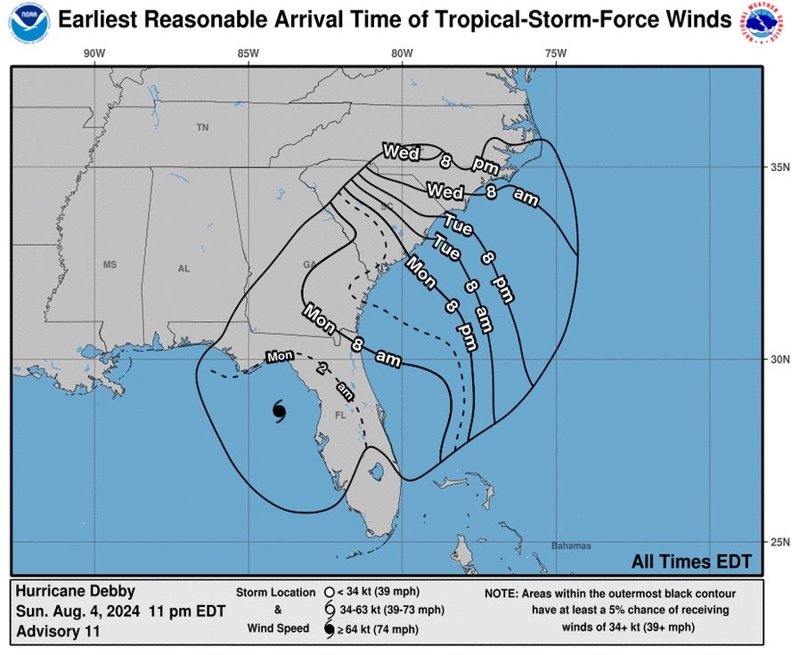
The hurricane is forecasted to move across northern Florida and into southern Georgia, where the National Weather Service says it will “weaken to a tropical storm”, before dipping into the Atlantic Ocean.
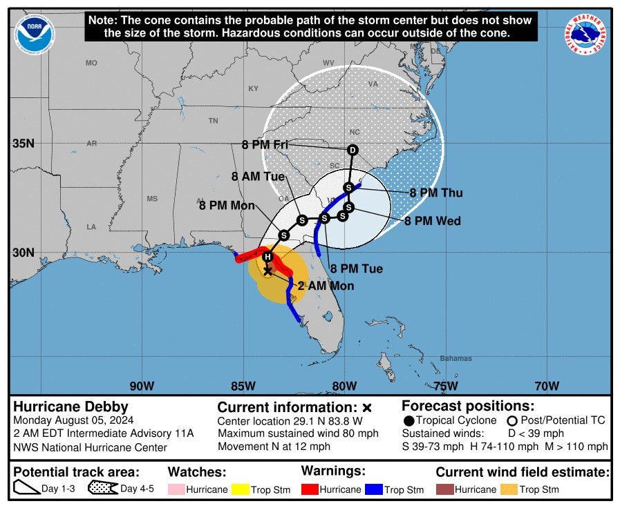
This means dangerous winds are also forecast to hit Georgia, South Carolina and parts of North Carolina from Monday through Wednesday before the storm dissipates at the South-North Carolina border at around 8 pm Friday.
Georgia Governor Brian Kemp and South Carolina Governor Henry McMaster also issued emergency declarations for their states.
Once over the Atlantic, Debby is not expected to regain hurricane strengthen, meaning South Carolina, Georgia and parts of Florida’s northeastern coasts are under tropical storm rather than hurricane warnings.
However, National Hurricane Center (NHS) director Dr Michael Brennan said the storm slowing down over land could “exacerbate not just the rainfall risk, but also the potential for storm surge and some strong winds.”