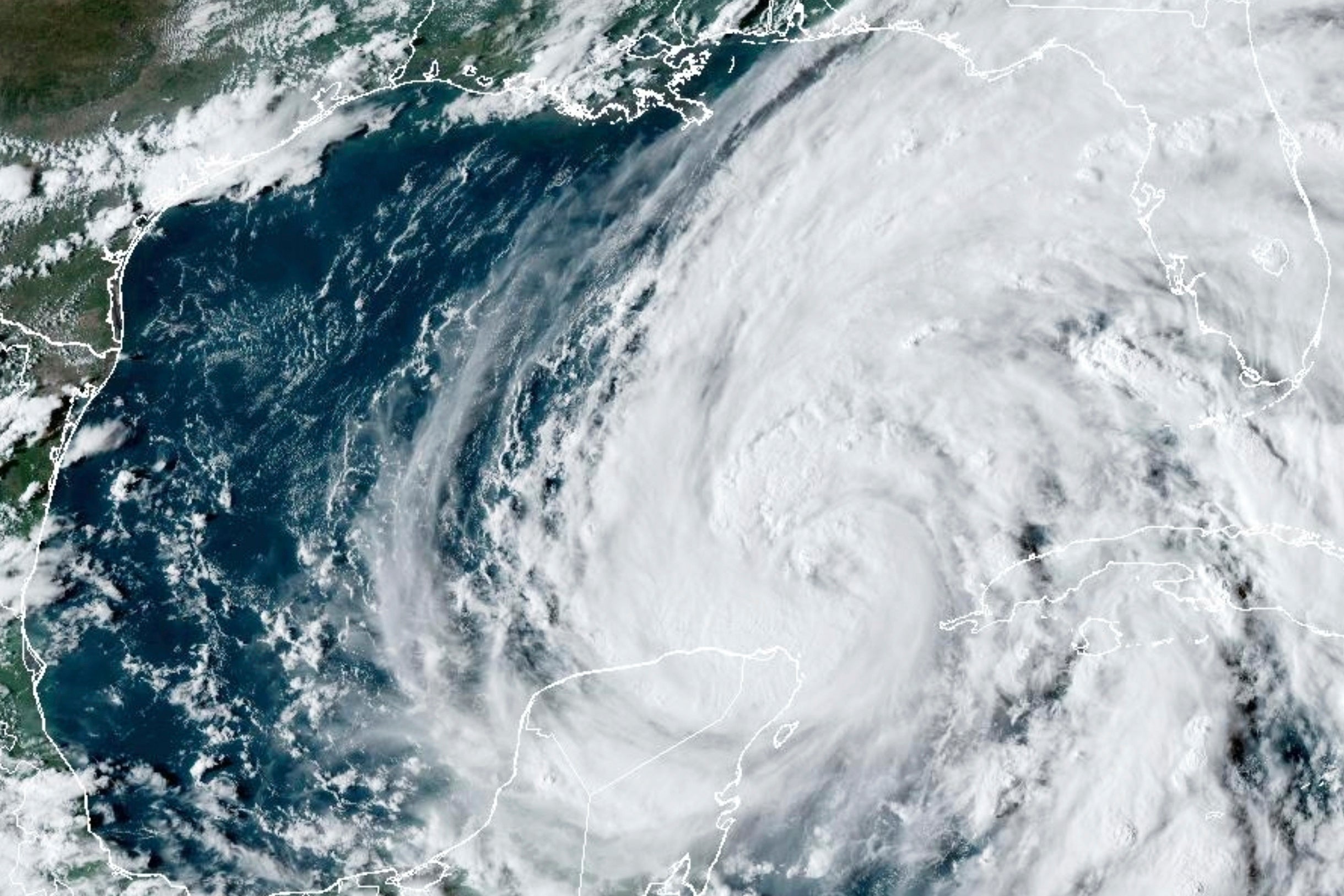
Floridians are currently bracing for catastrophic winds and storm surge as Hurricane Helene is forecast to make landfall along the state’s west coast on Thursday as a potential Category 4 storm.
Forecasters have warned that Helene will strike near Florida’s Big Bend region at some point this evening.
The storm could be the strongest to batter the US in over a year, as it is expected to strengthen from a Category 1 into a Category 4 over the coming hours, according to AccuWeather and the National Hurricane Center (NHC).
In a statement posted to X in the early hours of Thursday morning, residents were urged to “rush” their preparations for the storm.
The NHC warned that a catastrophic and deadly storm surge reaching as high as 20 feet will hit parts of the Big Bend coast, with the “danger of life-threatening storm surge” across the whole of the western coast of the Florida peninsula.

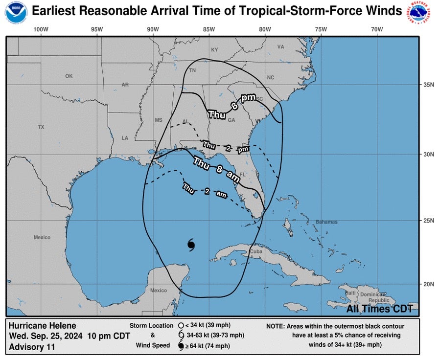
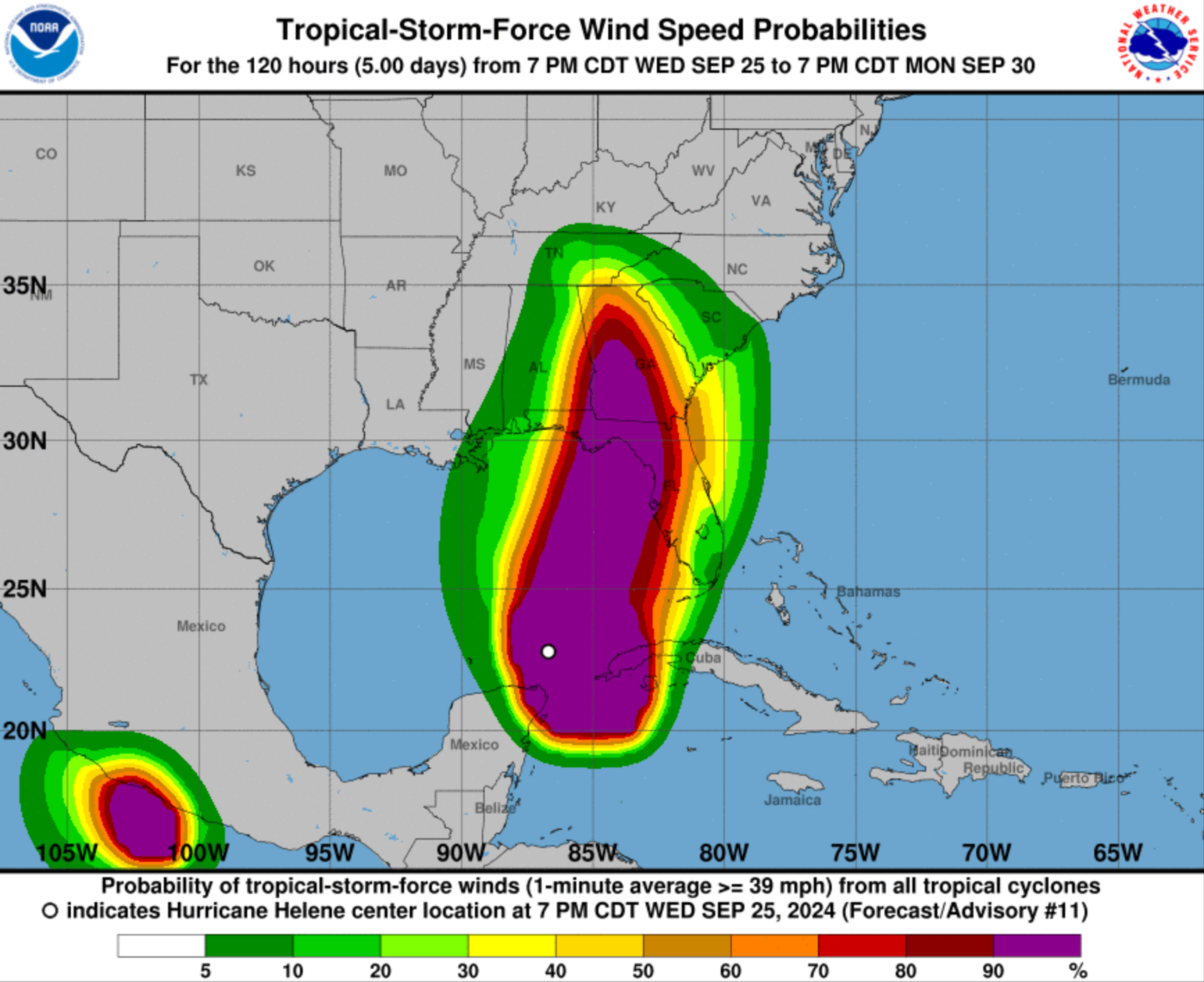
“Damaging and life-threatening hurricane-force winds” are forecast to move inland into parts of northern Florida and Southern Georgia late Thursday and Thursday night, the NHC warned.
Strong wind gusts are also expected to reach parts of northern Georgia, South Carolina and North Carolina.

After landfall, Hurricane Helene is expected to slow down and turn north, advancing over the Tennessee Valley on Friday and into the weekend.


Governor Ron DeSantis previously issued a state of emergency for 41 counties on Monday, highlighting the serious threat of the storm surge, wind and rain expected to pummel the region.
This will be the fourth hurricane to make landfall in the US this year, coming just over a month after Storm Debby slammed into the Sunshine State

