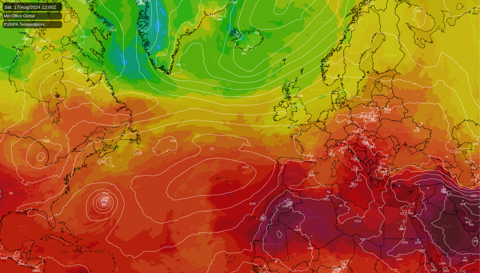
The weather is looking set to be quite ordinary for the time of year over most of Europe during the coming week, with a strong jet stream sending low pressure systems to the north of Britain and into western Scandinavia, and relatively high pressure further south and east. However, it looks probable that the recent Spanish heatwave, after a temporary lull last week, will continue during the coming week.
Meanwhile, it is increasingly looking highly probable that ex-hurricane Ernesto will spread eastwards across the North Atlantic next week, and that a depression containing the remnants of Ernesto will hit Britain on Thursday or Friday, most likely especially affecting the north-west of Britain.
Heatwave in Spain and the Balkans
Most inland parts of both southern Spain and southern Portugal can expect temperatures into the low 40s Celsius today, although coastal resorts will be cooler due to sea breezes. The heat is set to become less intense for most of the coming week, but more widespread. Throughout Monday to Friday next week, the southern half of Spain can expect daytime maximum temperatures close to 40C, again except along coastal fringes.
It isn’t just Spain either: temperatures in excess of 40C are forecast for today in parts of the Balkans and in south-eastern Italy. Like in the southern half of Spain, these regions are not expected to see any particularly outstanding individual hot days during the coming week, but temperatures will be consistently above the long-term average, mostly peaking just below 40C. Often such prolonged periods of hot weather, especially when combined with high overnight minimum temperatures, are more deadly than short but intense bursts of heat.
Heat in the UK
While Britain has mostly avoided major heatwaves this year, last Monday saw a substantial short sharp burst of heat into the eastern half of England in particular, with the Met Office confirming a maximum of 34.8C in Cambridge. While it was nowhere near as hot as 19 July 2022, which saw temperatures reach or slightly exceed 40C at several sites as far north as Lincolnshire, such temperatures into the mid-30s Celsius have become considerably more common since the mid-2010s.
August has also got off to a warm start, although as in many recent warm months, apart from that one-off hot day, this has mainly been due to a lack of cold days rather than any outstandingly high temperatures. However, summer 2024 is not looking set to be a warm one by recent standards, because both June and July had temperatures that were very close to the old 1961-1990 average, and close to 1C below the average for 1991-2020, for most of the country. The relatively warm August may be enough to bring the summer into line with the recent average.
Upcoming weather for the UK
A very marked northwest-southeast split is expected in Britain’s weather during the coming week, with relatively high pressure in the south-east of Britain keeping the weather predominantly dry over the majority of England and Wales, while in western Scotland and Northern Ireland, and into Cumbria, it will frequently be wet. For example, the GFS model is forecasting 3mm or less of rain between now and next Wednesday in most of the eastern half of England, together with east Wales and the west English Midlands. In contrast, much of the west and south-west of Scotland can expect 50mm or greater in the same period.
Sunshine amounts will be variable, because frontal systems will be frequently moving from west to east across the country, and although these will not produce much, if any, rain in eastern, central and southern England, they will often bring plenty of cloud with them. In between these systems, most of England can expect plenty of sunshine, while in western Scotland and Northern Ireland, there will be some brighter weather mixed with showers.
Through next Thursday and Friday, and possibly into next weekend, there is potential for some very windy weather associated with the remnants of Hurricane Ernesto, particularly in northern Britain, with a significant possibility of gales especially in the north and west of Scotland. South-eastern Britain may largely miss the wind and rain associated with this. This will probably clear away by the Bank Holiday Monday, promising quieter weather especially for the south.
Looking further ahead, although Ernesto could temporarily disrupt the pattern, there is no clear end to the northwest-southeast split pattern on the horizon, and it could well persist through to the end of August.

