

The overall theme for this week will be blustery showers from the west with more bright, even sunny, spells further east. It will feel quite warm in any sunshine but in the shade and once the sun has disappeared it will feel cooler. For early mornings there will almost be a hint of autumn, like an old memory, as the air changes. Atlantic low pressures will bring longer spells of rain and blustery winds, even gales at times. Wednesday and Thursday are being highlighted for an episode of wet and windy weather with particular concerns for western Scotland and a risk of flooding. Western Scotland is, of course, used to heavy rain climatically but parts of the UK are still on holiday season even if the local school children are already back in the classroom.
In the southerly flow on Monday, it has felt warm even with cloudy skies. As eastern England reaches the mid-twenties there will be heavy rain for western Britain and behind that, a shift to cooler, fresher Atlantic air.
What is catching the eye is Hurricane Ernesto. This cyclone hit Bermuda at the weekend causing wild seas, power outages and minor damage. It had continued northwards towards Newfoundland but will remain offshore and then change from a tropical cyclone to an extra-tropical low. It then becomes ex-Ernesto as a distinct low pressure but with different characteristics and structure moving over much cooler waters.
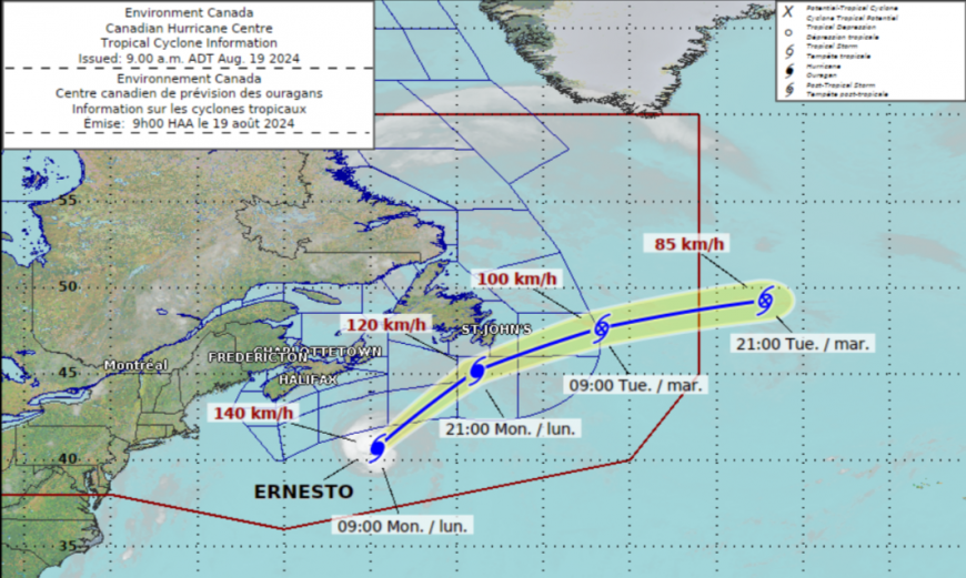
“The hurricane has reached peak intensity as it approaches southern slope waters this morning. (The Slopewater is a mixture of water from the Labrador Current and coastal water from inshore of the continental shelf). These colder waters north of the Gulf Stream and the increase in wind shear from the mid-latitude westerlies will induce the process of extratropical transition sometime today…the transition should be complete by early Tuesday morning. Ernesto will become absorbed by a larger extratropical cyclone once it moves east of the Grand Banks.” Canadian Hurricane Centre
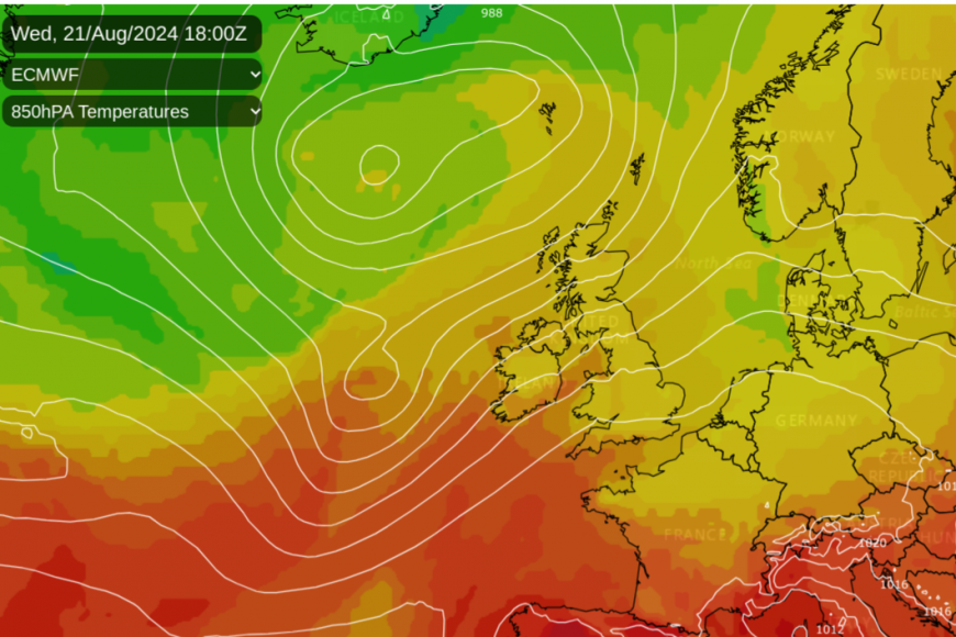
The north Atlantic is a busy place with other low pressures. What was once Ernesto gets drawn in by a low pressure near Iceland in the middle of the week. The moisture and warmth from the ex-hurricane get stirred up and those remnants add extra oomph to the weather heading towards the UK. It is incorrect to say “Hurricane Ernesto to batter UK” in your ‘Live’ headline. By Wednesday it won’t be a hurricane anymore.
The UK has seen some proper summer weather with heat and sunshine. This mobile westerly setup means that there will be several unsettled days with blustery showers and sunny spells. SEPA is the Scottish Environmental Protection Agency and has highlighted a wide part of western Scotland for “further and potentially significant disruption due to flooding expected on Wednesday” after heavy rain to start the week in the southwest.
 SEPA
SEPA 
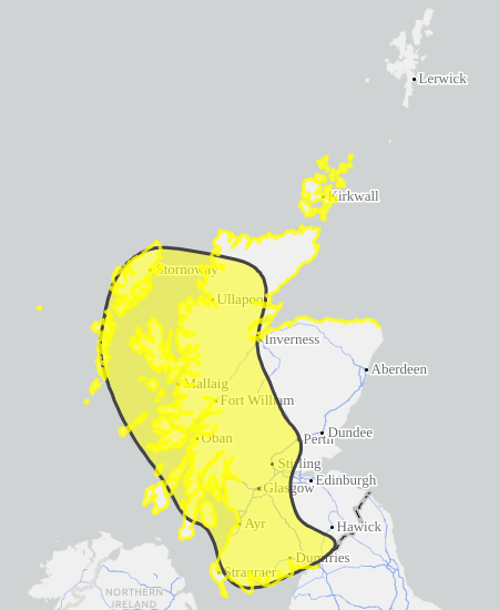
The UK Met Office has a yellow warning for heavy rain which runs from Wednesday until Thursday afternoon.
This will be heavy and persistent rain, orographically enhanced by the high ground of western Scotland. Argyll and West Highland are mentioned with up to 100mm expected, even as much as 150mm over some hills, that’s six inches of rain. Southwestern Scotland is in for a wet start to the week and there could be 50mm (2”) more in this region.
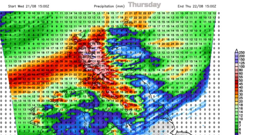
It will also be very windy, initially for northwestern parts of the UK by Wednesday lunchtime in a fresh to strong southerly. Northern Britain will have a gusty evening and night as the rain just keeps on coming for Northern Ireland and western Scotland.
Ready for the Thursday morning commute there could be heavy rain and strong, gusty winds, even gales for exposed hills and coasts around the Irish Sea, Solway Firth, the Isle of Man and heading into Cumbria and Gwynedd. Irish Sea ferry services may be disrupted.
The rain will soon sweep across Scotland but there will be lively winds for the higher level or exposed routes of northern England. Another concern will be coastal flooding in the west and north as high tides combine with a surge and large waves. This may cause further disruption.
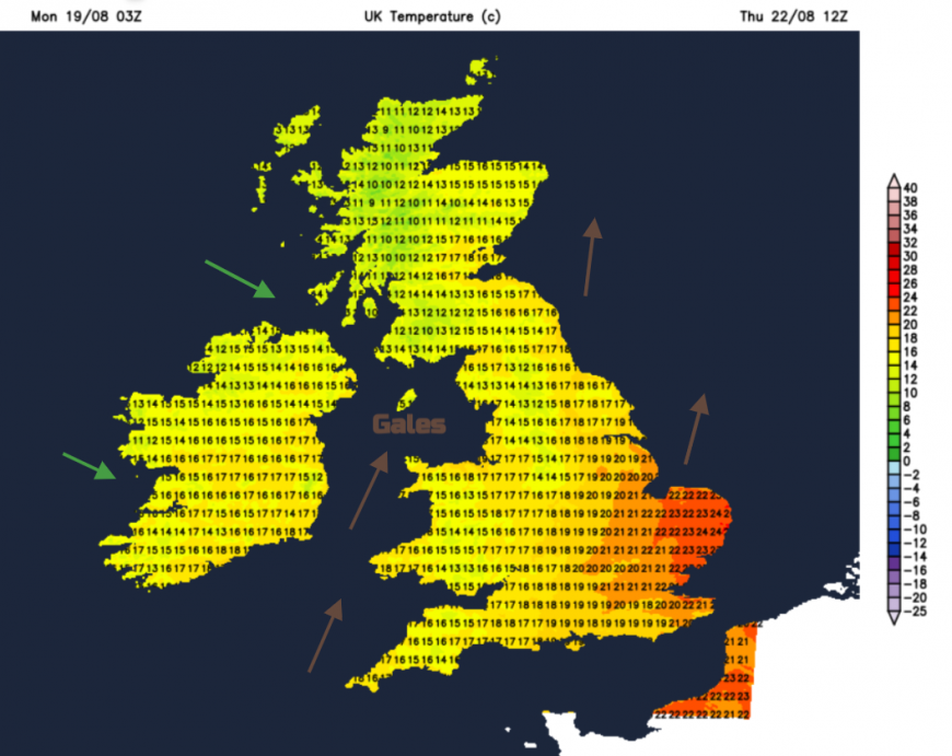
Not everywhere will be hit by heavy rain and strong winds. The rain really will be focused on northwestern Britain, Northern Ireland and the far north of Scotland. Other areas will see very little. And with warm air wrapped up with the remnants of Ernesto and a southwesterly flow ahead of the frontal rain, eastern England will be warm again on Thursday.